Tour #6: Unusual Geologic Structures

DSC_0146

You are now at the South-West ‘gate’ of RockWalk Park, that leads out to the west end of Probyn Street. A bus stand/shelter is located here. For visitors coming into the park from this location, there are several choices of direction to take.  The right path leads back up the route you have just come from, but also diverts to the South-East entrance at the corner of Probyn and Latchford Streets. Along this path is the “Yellow Brick Road” where the exhibits of gold ore are located. 

A ‘trail’ across the lawn (westward) toward the railway track and then a sharp turn right will put you on the winter snowmobile bypass. This is a good place to walk a dog in any season and view specific trees that were planted as part of our regional Arboretum. It comes out at the north end of the College parking lot. 

The left path is known as “The Inca Trail”. It represents the path of Canadian Geological education and experience that has led Canadian geologists…and companies…to become the core mining developers of South America.) This path leads into the section on ‘Unusual Geological Structures’, and beyond that ‘The Effect that Rocks have had on various World Cultures’.  Between these two paths, an opening leads straight ahead to the mound that symbolizes the shape of a glacial ‘drumlin’. This accessible structure is designed to allow a view of the entire Park, Northern College and its dormitory, and Lake Temiskaming beyond. 

The entrance to the ‘Drumlin’ is framed by two large specimens, which are representative of the routes in either direction.  The sample on the right (NMO26) is a large piece of very low grade ‘gold ore’ containing green fuchsite mica and both white and brownish carbonate. It is similar to the gold ore seen at MO#1E, but this sample was extracted as dimension stone, rather than for its gold content. The cut and polished material was sold as table tops, etc. in the 1990’s, but a suitable market was not established. Notice the remnants of drilling found on the sides of this sample. These holes were placed for pre-shear drilling and blasting as a way of extracting the block (intact) from its bedrock source.  It comes from the Virginiatown area, and is indicative of both the metallic ores up toward the ‘Yellow Brick Road’ and the dimension stones of the Non-Metallic Ore area.  

The INCA TRAIL (of Unusual Geological Structures)

UNGS#1A

This specimen comes from a sand/gravel pit on the west side of the Kam-Kotia Road, near the Hwy 101junction that is just west of Timmins.  The curved lines running through the sample highlight the structure of particular interest.  Notice the shape and pattern of these curved lines.  They are formed under the sea (subaqueous) as new volcanic lava erupts onto the sea floor.  The outside surface of this lava is cooled by the seawater, to form a sort of ‘plastic-like’ skin, whereas the interior of the flow remains extremely hot.  The hot liquid pushes into the ‘skin’ and expands it until a bulbous balloon-like mass breaks off the front of the flow and rolls down the slope to settle on top of previous masses.  The outlines of the ‘skin’ are the curved lines seen in the rock today.  

As the entire mass, called a pillow, is still semi-liquid or plastic-like in terms of rigidity, it can conform to the shape of whatever structure it sits on.  In this case, the underlying structural shape features pointed depressions between the curved masses of older pillows, so the new pillow acquires a circular or elliptical cross-sectional shape with a prominent pointed protrusion (or ‘gore bottom’) on its base.  Because of this structure, geologists can now draw conclusions about any rock in which they see this type of structure.  First of all, they know that the rock is volcanic, and that it was formed undersea.  Secondly, they can use the gore bottoms to decide which way is the original ‘top direction’, even if the rocks have been subsequently folded, faulted, or otherwise disturbed.

Exhibit and signage provided by M.J. Labelle Co. Ltd. of Cochrane ON, on behalf of Denis Labelle – Provincial Institute of Mining 1960-62.

Internet Video…seek: Amazing Underwater Pillow Lava – Hawaii 2008

UNGS#101

A second sample of Pillow Lava was obtained from the Kirkland Lake area. There is currently no geologic description of this exhibit. However, it is dedicated to the 2021 Kirkland Lake Works Department staff, who were instrumental in providing the exhibit. 

Internet KL “culture”…seek: Swastika Mine-Tavistock & District history

UNGS#102

This is low-grade gold ore from the St. Andrew’s property in Hislop Twp., near Holtyre, Ontario.  Some of the brownish colour is due to the presence of ankerite carbonate. This mineral is a combination of calcium, iron, magnesium, and manganese carbonate…closely related to dolomite. 

UNGS#103

This black, low-grade gold bearing rock is from the Golden Arrow property near Ramore, Ontario.  Note the folding, sulphides, and alteration staining. Compare to the Arrow sample at MO#1H.

UNGS#104

This sample is also from the Golden Arrow deposit near Ramore, and is similar to UNGS#13.  Here, a pinkish granitic dyke has intruded similar fine-grained, dark-coloured host rock as seen in UNGS#103.

UNGS#105

These are Turbidites (formerly known as slatey greywacke…derived from an old German name for such sediments). The slabs are from west of the Highway #11 bypass.  Such slabs are typical of the Firstbrook member of the Gowganda Formation, already described at LRT#4B.

Turbidites are found in meta-sedimentary subprovinces where deep sea sediment has slumped down from the margin of land masses. Locally, it is situated below the younger Coleman ‘Arkosic Quartzite’ and above the older Coleman ‘Lower Conglomerate’/Gowganda Tillite. About 2.2 BYO. However, the jury is still out on how they are formed, in recognition of new data described in 2021…

Internet controversy…seek:Turbidite – an overview – ScienceDirect Topic

Signage Sponsored by Wayne’s Corner Garage (Cobalt, Ontario)

UNGS#106

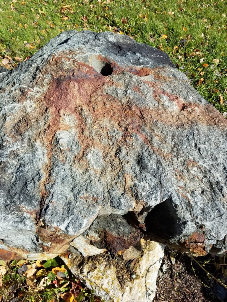
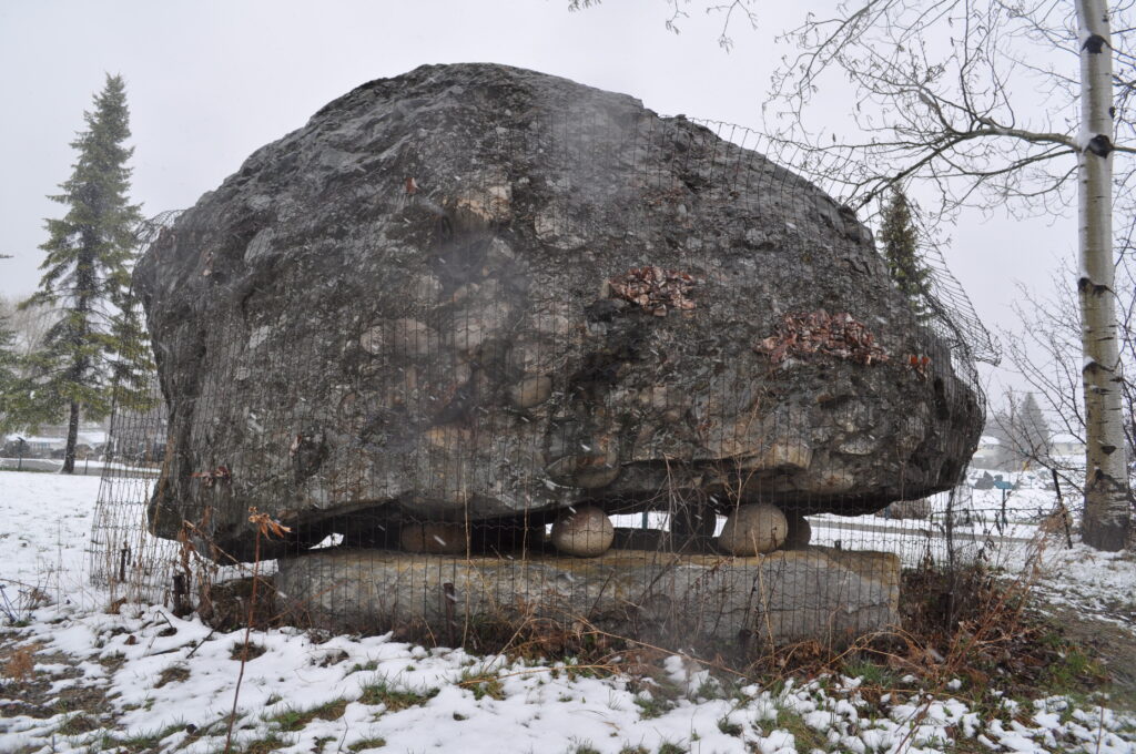
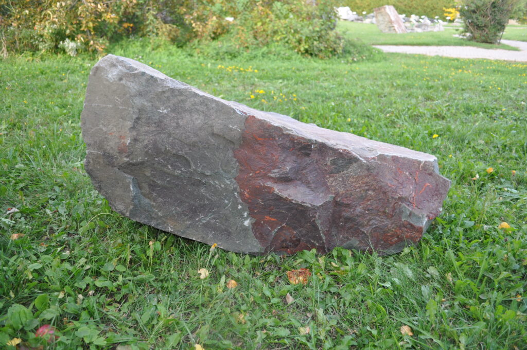
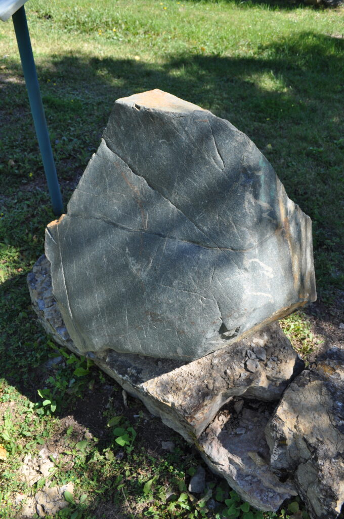
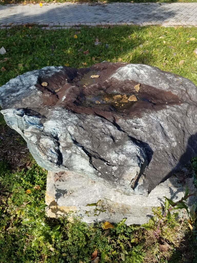
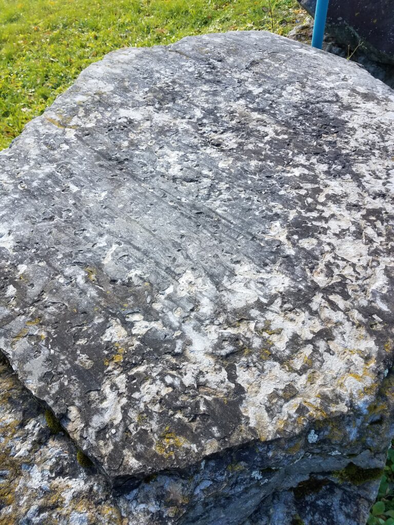
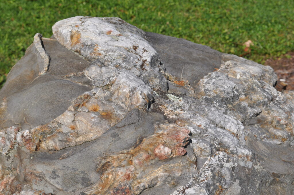
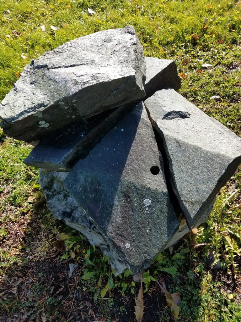
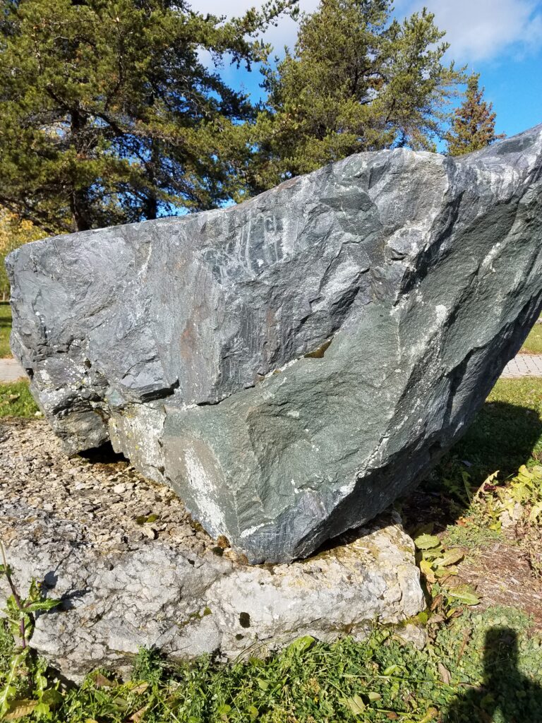
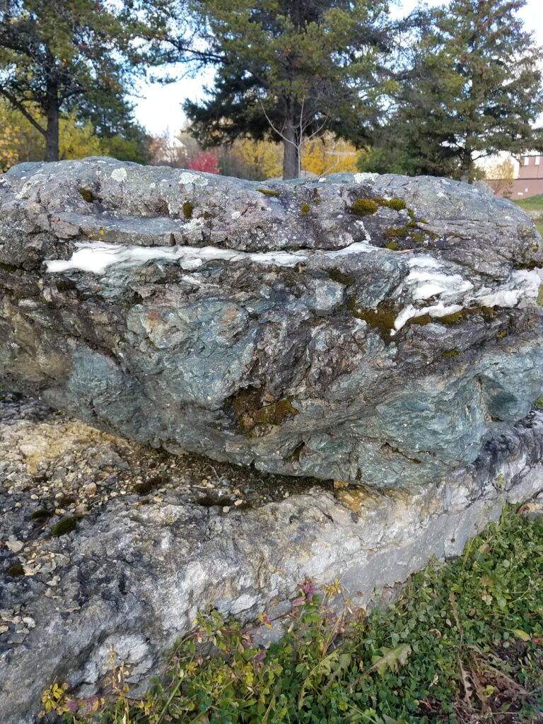
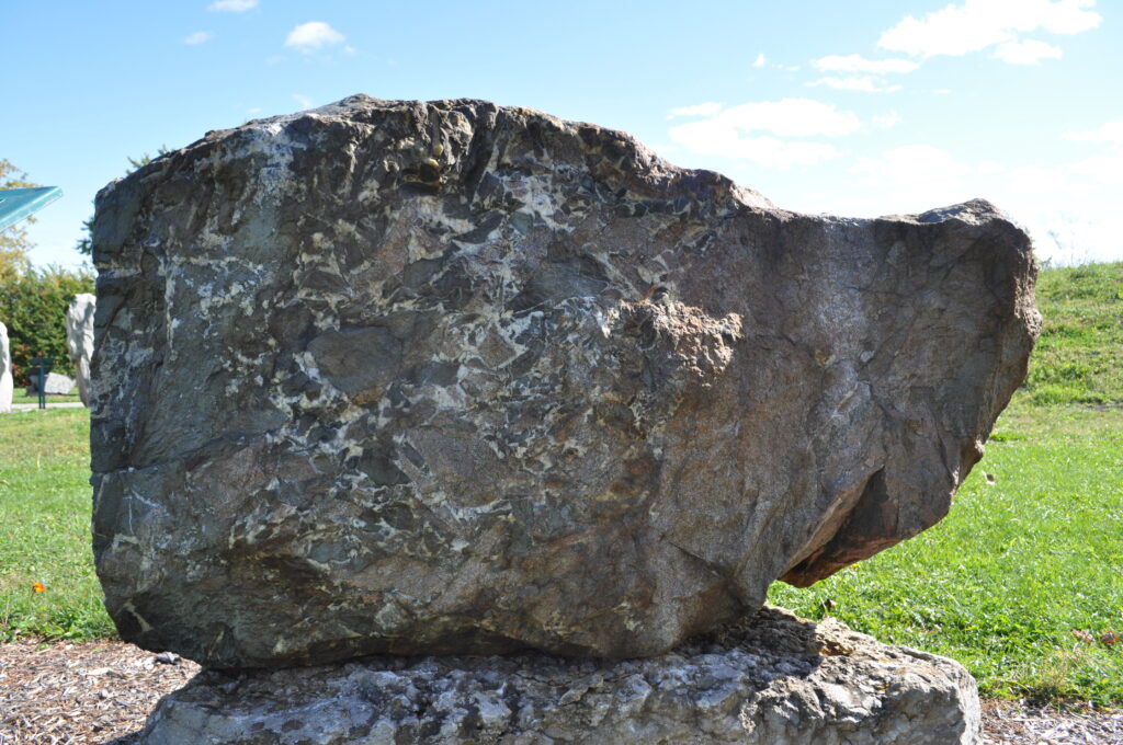
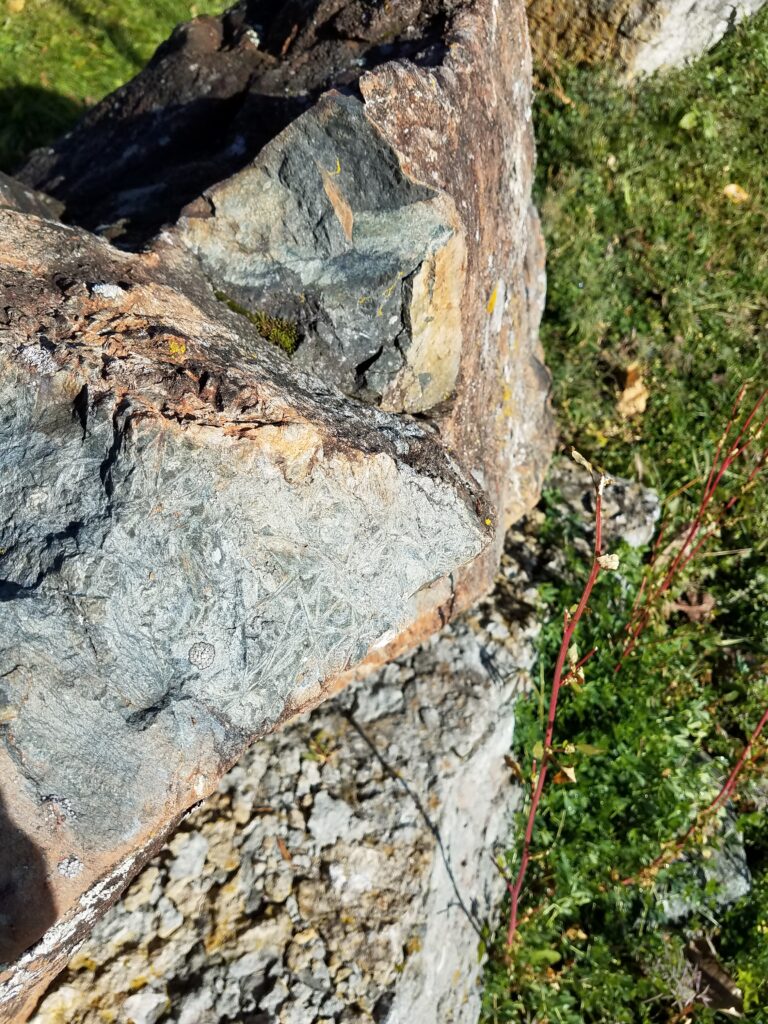
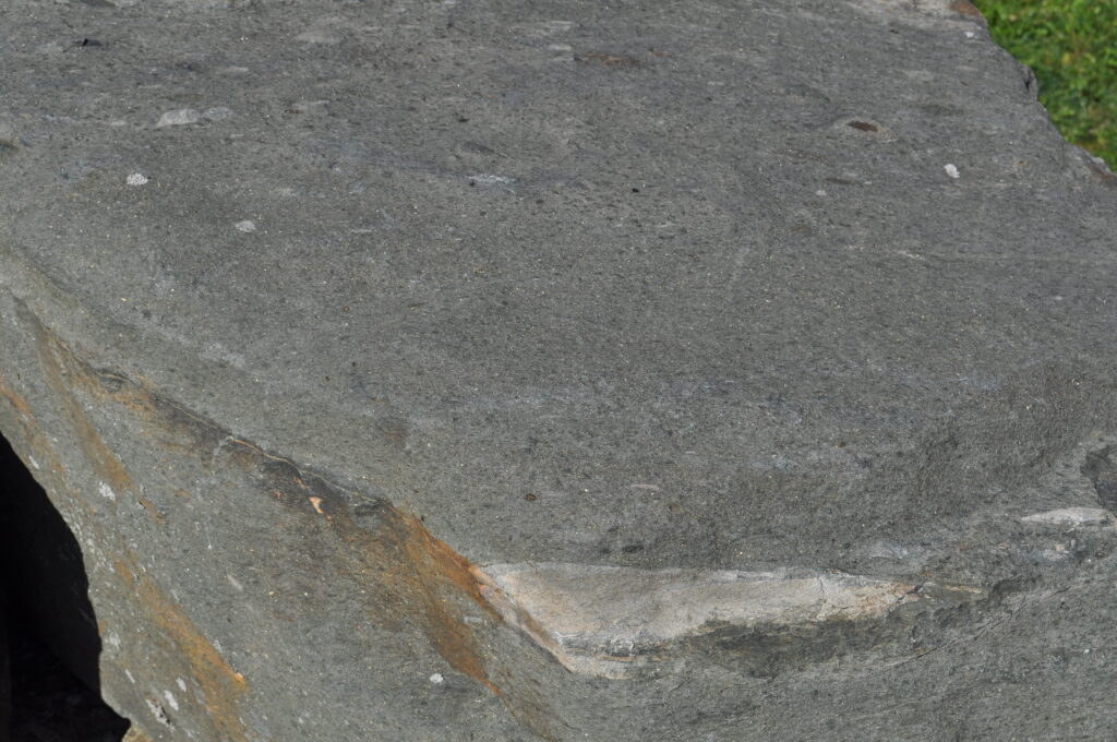
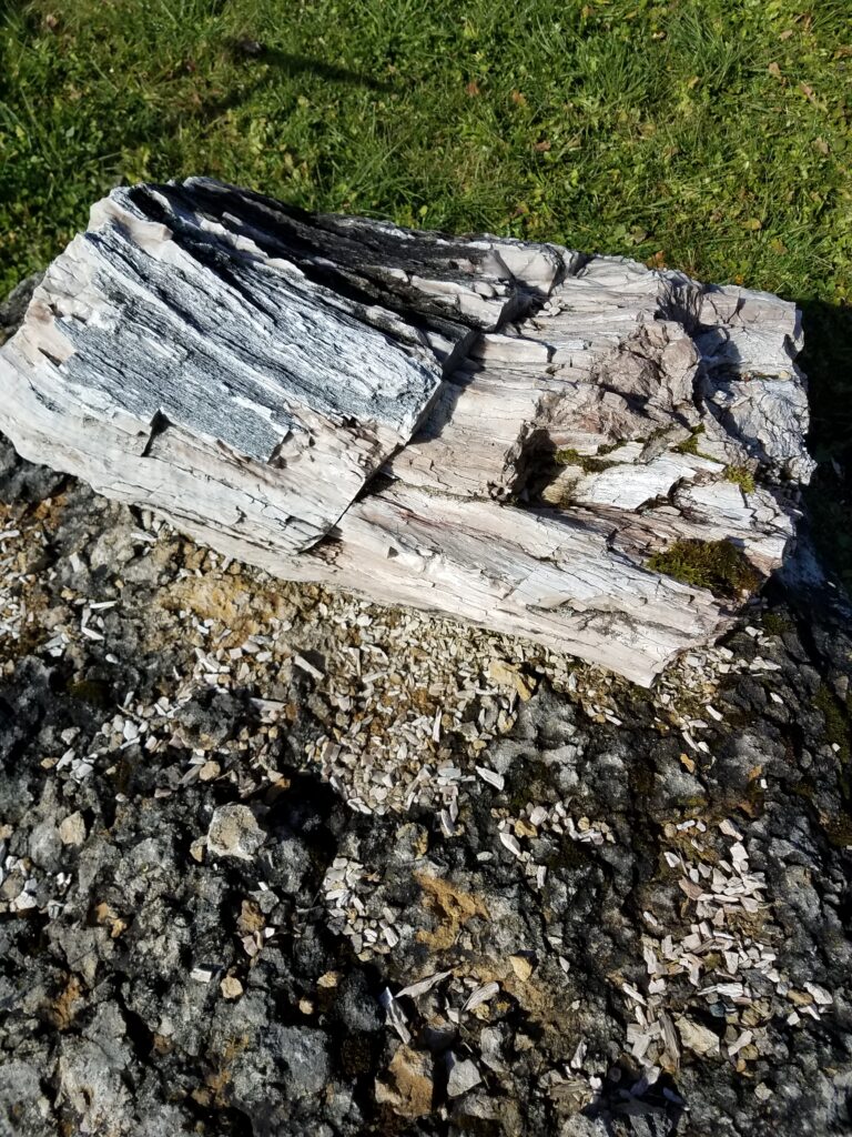
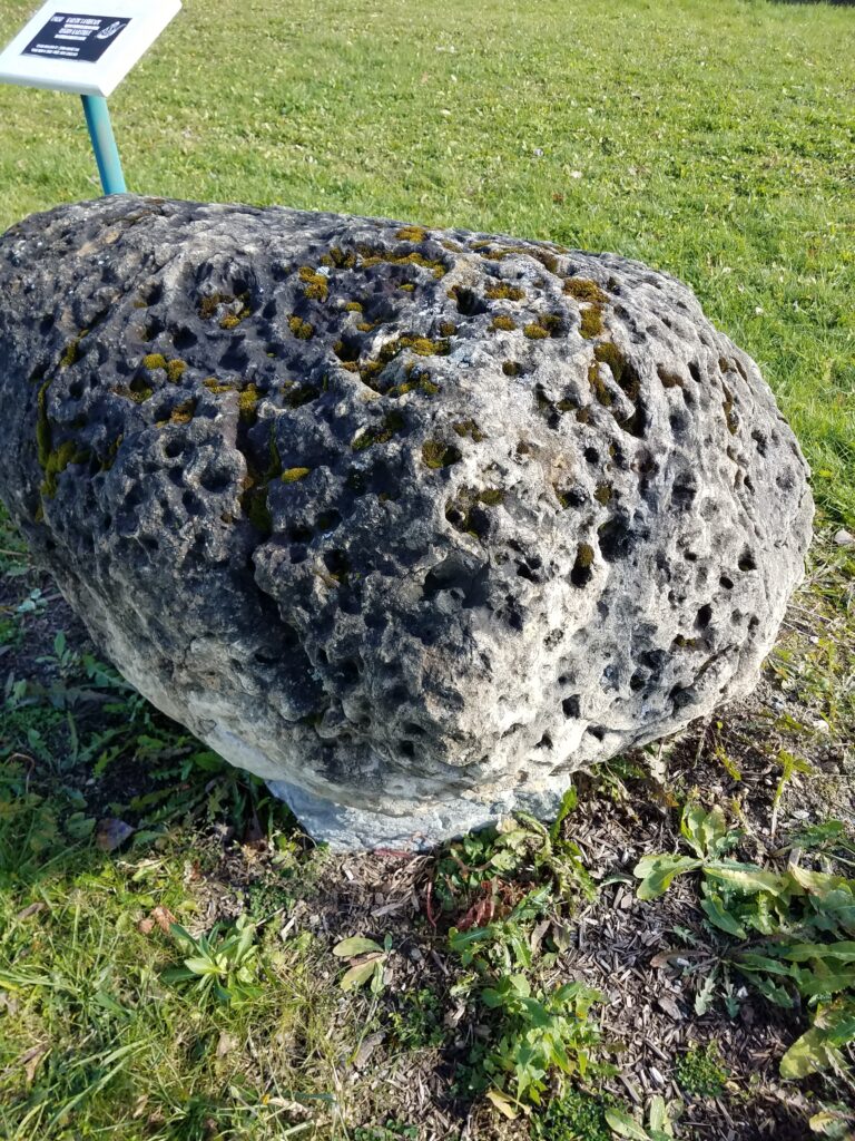
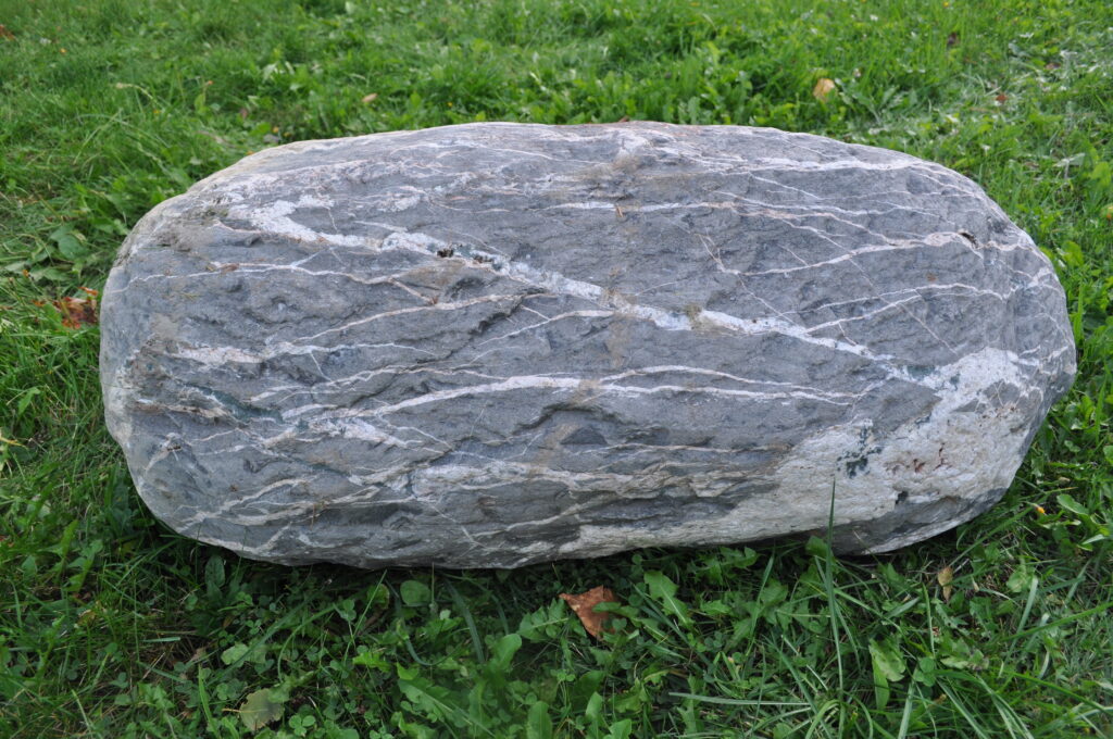
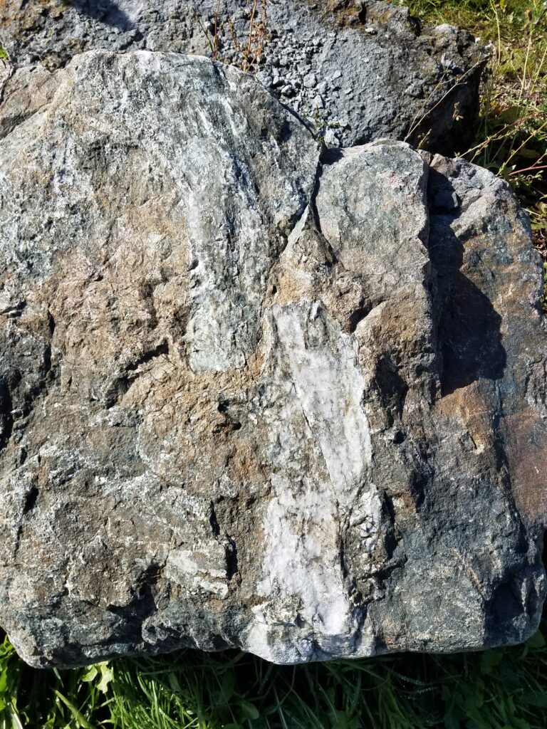
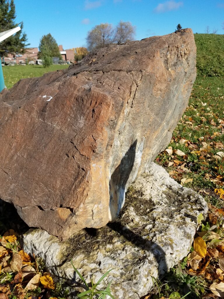
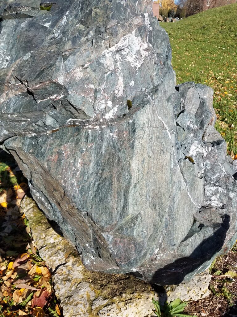
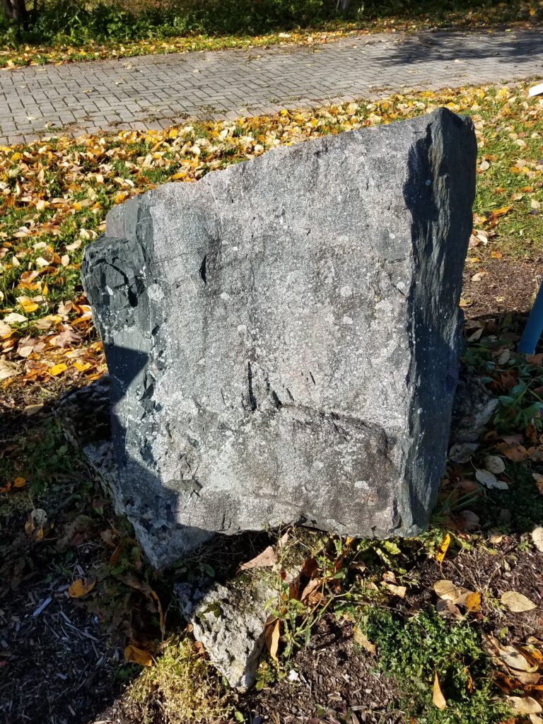
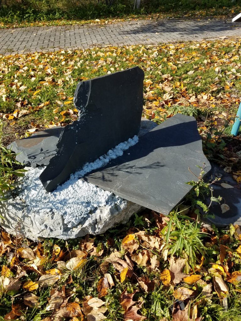
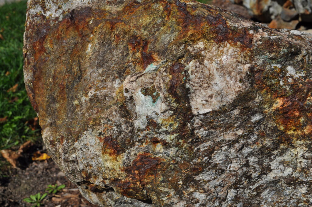
These samples (one large and two small) are copper/nickle/platinum group ores from the Kanichee property within the small 2.7 Ga Temagami Greenstone Belt. The sulphides have been heavily altered to gossan (partly ‘rust’, which prospectors use as a guide to the presence of such minerals).  The medium size sample shows high-grade sulphide ore (see MO#3B) on the edge of waste similar to that shown in UNGS#107.

Signage supplied by Caldwell Construction (New Liskeard, Ontario)

Internet explanation…seek: Temagami Greenstone Belt – Academic

UNGS#107

This is another sample from the Kanichee property north of Temagami.  It is an ultramafic rock, showing a felted mass of tiny feathery, radiating crystals of fibrous amphibole (?), possibly altered from clinopyroxene.  There is some disseminated pyrrhotite & chalcopyrite as well.

Internet detailed geology…seek: MNDM Geology ON Kanichee Intrusion

UNGS#108

The sample of float was ‘rescued’ from the Cabo properties south of Cobalt.  It is a metamorphic rock featuring dark coloured biotite granitic gneiss cut by an intrusion of light coloured granitic aplite.  The aplite has the same composition as granite, but is finer grained, and more resistant to erosion – hence the ‘cap-like’ protrusion on the side of the sample. Quartz and feldspar are the dominant minerals + minor microcline and albite. As the aplite consists of particles under 1mm in size, it shows that crystallization was rapid, resulting in a stronger rock. 

Signage sponsored by Laframboise Drilling Inc. (Earlton, Ontario)

Internet explanation…seek: Aplite – Igneous Rocks – Sandatlas

UNGS#109

This sample was discovered in a gravel pit near Elk Lake, Ontario.  It is either an igneous intrusive rock or a metavolcanic rock, both of which are comprised of a glomero-porphyry, in which phenocrysts (the light-coloured minerals – see description of UNGS#110 below) coalesce into larger masses – all within a dark, fine-grained matrix.  This type of rock is similar to a type that can be seen in a number of metavolcanic outcrops around the Timmins area.

Internet magnified photos…seek: Glomerophyric texture-Alex Strekeisen

UNGS#110

This sample is classic Matachewan Porphyry (also known as Bannockburn Porphyry) from the Matachewan area.  Porphyry is an igneous rock in which some of the mineral constituents (commonly plagioclase feldspar) start to crystallize at depth within the parent magma.  When this magma is eventually tapped by a fracture or some conduit leading higher in the Earth’s crust, it intrudes as a magma slush (containing some of these pre-formed crystals) up into a higher position where the temperature and pressure are lowered.  The remaining liquid crystallises into a fine-grained matrix, with the earlier larger crystals scattered through this matrix as ‘phenocrysts’.  The Matachewan Porphyry is ‘famous’ as a porphyry because the feldspar phenocrysts are so well formed. 

  This sample is dedicated in memory of Cranbrook B.C. native Jack Frey, B.Sc. P.Eng., Haileybury School of Mines teacher 1954-67, Dean 67-89. Mining was always his passion, and the Haileybury School of Mines was his vocation. 

Internet Geology..seek: Matachewan Porphyry-Peter Russell Rock Garden

Now you’re at a bend in the path, and directly to the west (to your left with respect to the direction you’re heading) is a huge sample surrounded by wire fence screening.  This sample is CUL#4, and is described below:

CUL#4

This huge rock is a glacial erratic that was deposited during the last ice age (about 15,000 to 10,000 years ago) near the Haileybury Town workshops up on View Street West.  It took many attempts with several cranes before we were able to lift and move it.  On the last attempt, an 80-ton crane was able to lift it and weigh the rock at 45 tons (Imperial measure).


UNGS1B

This sample is similar to the large pillowed specimen seen at UNGS#1A insofar as it is volcanic.  However, this specimen has been broken into many pieces by explosive volcanism, and re-cemented during deposition.  If you look closely, you can see a type of mottling where separate fragments or clasts occur.  It is called a hydroclastite, the ‘clast’ part of the name referring to the fragments, and the ‘hydro’ part referring to the rock having been broken or fragmented during chilling under water or ice.  This particular specimen comes from the Potter Mine area in Munro Township east of Matheson.

Internet…seek: Hydrovolcanic Processes – Volcano Information Center

UNGS#2

Superior Province ‘Greenstone’: This glacial float exhibit was obtained from a “Glaciofluvial Outwash Deposit” located in Coleman Township. As such deposits do, they also contain boulders as well as sand and gravel.  Therefore, the exhibit probably originated between the Timmins area and  Kirkland Lake, and north of both Englehart and Elk Lake. It is noteworthy due to the presence of a brick-red coating that appears on stress (?) cracks. Further geological interpretation is required.

UNGS#3

Some of you may have experienced places like Wasaga Beach, Sauble Beach or Ipperwash.  There, the sand forming the lake bottom is hard-packed, and one can walk out in shallow water for long distances on sand ripples. These very small ripples can be preserved in the rock formed from such fine sediment, and here’s an example.  The rock is sedimentary and it indicates agitation by the water. This one comes from the “Little Silver Vein” host rock at Cobalt. You can see and feel the ripples on the top surface, and see a cross section below where identical ripples were made over centuries. Again, this is a ‘top indicator’, as geologists can decipher the original ‘up’ direction, no matter how disturbed or tilted the rocks are.

Internet…seek: Ripple Mark – an overview – ScienceDirect Topics

UNGS#4

The front face of this specimen illustrates how polished and smooth rock surfaces can be, simply as a result of glaciation.  (The scratching occurred during transport to this site).  This sample comes from a small vertical face at the Kanichee deposit north of Temagami.

Internet explanation…seek: The coating layer of glacial polish – Geology

UNGS#5

Another example of glacial smoothing is shown here, in this case from the Hedman deposit in Munro Township (see NMO#27E).  If you look closely, you will see some striae or striations, scratches left by the movement of glacial ice containing rock fragments over the surface.  Also, on the side is some green serpentine mineralisation, similar to that seen in some of the asbestos samples earlier, showing a different kind of striation.  Here the lines in the serpentine are aligned along a fairly planar surface, which probably represents a slip surface.  As the blocks on either side of this slip moved past each other, the surface was smoothed and ‘greased’ with serpentine.  The resulting lines are called slickensides.

Internet: Ice Age: Glacial Striation – Canada (Ontario) Beneath Our Feet

UNGS#6

Glacial striations and chatter marks are visible on the surface of this limestone from the area of St Eugene de Guigues, Quebec.  It is known as the “Guiges Formation” of the Upper Ordovician marine nearshore environment. The striations or striae are gouges or scratches left by the broken rocks encased at the base of glacial ice as it moves across bedrock.  The average direction of striations in this whole region is N12oE; however, glacier ice was commonly diverted down paths of least resistance, and the Lake Timiskaming Rift Valley was known to steer local ice lobes off the main direction.  Chatter marks are the crescent-shaped marks left by broken rocks at the base of advancing ice sheets as it ‘skips’ across bedrock surfaces.

Signage sponsored by Laframboise Drilling Inc. (Earlton, Ontario)

Internet classroom…seek: Glacial Striations Explained!-You Tube

UNGS#7

This sample shows the effect of differential weathering.  The hard white quartz in this sample is much harder and more resistant to weathering, so as a result leaves resistant ridges raised about 2.5 cm above the other material.  This same process is responsible on a different scale for some hills standing high in relief whereas the surrounding material is easily weathered away to low valleys.

Internet classroom…seek: Weathering – Geology – Cliffs Notes

UNGS#8

This is a sample of Lorrain Valley quartzite from the highway rock-cut south of the Highway Bookshop at Cobalt.  The unique feature here is the cross-bedding, an important structure used in geological mapping to determine the original top direction of overturned rocks.  

Internet classroom…seek: www.geo.mtu.edu > Crossbedding

UNGS#9

This sample of silty dolomite comes from the Claude Breault Quarry north of New Liskeard.  Because of the fine silty sediment present here, the bedding planes between layers are easily seen on the side of the specimen.  However, if you examine these edges closely, you’ll see that even though most of the bedding planes are parallel, a few cross at an angle.  This cross bedding can be formed by either water or wind.  For example, when sediment-laden water from a fast-flowing stream enters a lake, the water is slowed right down and it loses its energy to carry sediment.  The sediment usually gets dumped right there to form a delta.  The cross-sectional shape of these sediments is something like what’s shown below, with a bulge in the middle stem. 

Fast melt water in the spring can sweep the tops off these unconsolidated sediments, and one is left with the shape shown here:

Again, this is used by geologists as a ‘top indicator’ since it shows which way the original top direction lies, even if the rocks have been since folded and tilted.

Internet classroom…seek: www.serc.carleton.edu.crossbedding

UNGS#10

The smooth angular surfaces on these samples are the result of jointing.  The top piece is mostly pinkish syenite, whereas the lower pieces are gabbro/diabase.  Both types of rock are igneous intrusive, meaning they were emplaced as molten magma, which cracked into joint patterns as it cooled.  Such joint patterns can yield some remarkably symmetrical hexagonal structures, such as at the Giant’s Causeway in Northern Ireland, the Devil’s Tower in Wyoming, and the Devil’s Postpile in California.  These particular samples come from the old underground Ryan Lake Mine property near Matachewan.

Internet tourism…seek: Giant’s Causeway UNESCO World Heritage Site

As a brief aside, you may notice across the path, the beginnings of another exhibit area, CUL#7.  This will eventually be located behind the screen of evergreen trees as a Zen Garden, or Garden of Meditation/Tranquillity.  The construction of this garden is on hold until we manage to acquire a sponsor.

UNGS#11

The host rock in this sample is banded iron formation from the Adams mine south of Kirkland Lake, Ontario.  As was seen along the ‘Iron Curtain’ pathway, such iron formation consists of alternating bands of magnetic minerals (e.g. magnetite) and silica (in this case greenish chert).  However, if you follow the bands carefully along the top and down over the edge, you’ll soon see that the bands are interrupted or ‘cut’ by a greenish material that is approximately one foot (30 cm) wide, before the bands continue near the base of the sample.  This ‘greenstone’ mass comprises an igneous intrusive dyke, since it cuts across the bedding planes.  The host rock would have been cracked at some point, and that crack served as a channel-way for the later igneous magma to intrude into its present position.  As further evidence of cracking and possible movement, the top surface of this specimen is smoothed and coated with smears of pyrite that shine in the sun. These (pyrite) slickensides (see UNGS#5) indicate that this surface was the site of fault movement at one time.  This particular dyke is rich in pyrite, and is the reason the block was not run through the mill.  It was separated out at the crusher, and found nearby after the mill was demolished.

Internet photos…seek: Gallery of Slickensides or Fault Mirrors

UNGS#12A

This example of glacial float from south of Cobalt contains torsion cracks on the top surface, and a vein of quartz running horizontally through the middle.  The host rock is green-grey schist that is known for its ability to fracture (from the Greek word “to split”). Torsion cracks are commonly short, curved, open cracks that line up en echelon within the host material.  They result from the twisting action that sometimes affects the host rock from in situ fault movement.  They are, therefore, indicators of nearby faults. This is an example of “noncoaxial shear”. Within the quartz vein that runs through the middle of the exhibit, are thin sharp rock fragments similar to those of UNGS#12B.  An assay of the quartz showed evidence of sulphides and traces of gold.

Signage sponsored by Nor-Arc Steel Fabricator (Earlton, Ontario)

Internet photos…seek: images for geology torsion cracks

UNGS#12B

This sample comes from the Teck Hughes Gold Mine at Kirkland Lake, Ontario.  This non-gold-bearing sample comes from the 3400-foot level of the ‘South Shaft’, via an interior winze. It carries magnetic inclusions within a calcite breccia.  It was extracted in 1962 by Don Decker and Al Murphy, under the direct request of Mine Mgr. George Gilchrist. Such a deposit had never been seen in the Kirkland Lake orebody before, and it was displayed prominently at the door of the mine office.   The Teck Hughes mine operated as one of seven primary gold mines in the Kirkland Lake camp from 1917 to 1968.  It was developed to the 6100-foot level, and the surface ‘glory hole’ can be seen behind the present day “Hockey Heritage North” sports museum at Kirkland Lake.  A cross-section showing of the ‘Main Break’, at a second cave-in site near the #1 shaft, is also visible. 

This exhibit is dedicated to the close-out staff, including Mgr./Geologist Ken Griffin, Engineer Len Jones, Mill Supt. Harry Ewing, Mech. Supt. Stan Clark, Elect. Supt. Jack Gambles, and Office Mgr. Tom Marston. Sample provided by “Hockey Heritage North”. Signage provided by Graham Gambles, H.S.M. Mining Technology Alumnus – class of 1973.  

Internet virtual tour…seek: MNDM Mining Heritage Tour, Kirkland Lake

UNGS#13

This is an excellent example of a breccia.  The process of a breccia has already been described under LRT#4G; however, in this case, the broken fragments are the result of a medium-grained pink granitic rock intruding into a fine-grained, dark green to black volcanic basalt.  The border zone of this intrusion is a breccia, composed of angular fragments of both rock types, and cemented by white quartz.  Such zones of intrusive breccia can be important hosts for mineralisation.  This specimen comes from the Golden Arrow deposit near Ramore, Ontario.

Internet Review…seek: BRECCIAS – Earth Science Australia

UNGS#14

These samples come from Munro Township, east of Matheson.  The rock-type is komatiite, named after the Komati River in South Africa.  It has an ultramafic composition, and was formed on ground surface as lava, where it cooled quickly in the lower pressure and heat environment.  Just as ice crystals can been seen to grow almost before your eyes as you look across a windowpane in winter, so the olivine and pyroxene crystals in this molten mass ‘took off’ in one direction as they cooled.  The resulting pattern is sometimes referred to as ‘chicken track’.

However, the definitive term was applied during the Australian nickel boom of the late 1960’s and into the 1970’s.  There, the desert plant, spinifex, has a very similar texture, so the term, spinifex, has been applied to this particular pattern of minerals ever since.  Since the texture tends to form in the upper half of the lava flow, it can be used successfully as another type of ‘top indicator’.  Excellent exposures are relatively rare, and the outcrop sites are cherished as geological wonders.

Internet explanation…seek: Komatiites – Alex Strekeisen

UNGS#15

A local rock-type commonly referred to as ‘lamprophyre’ is shown here.  Re-examination of the ‘lamprophyre’ exposures has resulted in recognition of rock-types not previously known to be in the Cobalt area.  This example is known as diatreme heterolithic breccia … which means as follows: breccia – broken, jigsaw-like pieces of rock; heterolithic – a variety of rock-types are represented in the fragments; diatreme – intrusion, commonly as a dyke or pipe.  In this case, this rock-type was first found in the Wawa area as a potential diamond host, and became the subject of diamond exploration in the Temiskaming area as well. A second sample can be viewed at LRT#5C

Signage sponsored by Laframboise Drilling Inc. (Earlton, Ontario).

Internet Nipissing Diamond…seek: Nipissing – Atacama Resources 

UNGS#16

This is a sample of petrified wood that was obtained in Texas. In Canada, petrified wood has been found in Dinosaur Provincial Park within the “Badlands” of Alberta, and it is the “Provincial Stone” of that Province. For the last 13,000 years, pre-contact indigenous people have made use of petrified wood in the development of projectile points.  Such rock types can be found around the world, and result from the fossilization of fallen tree trunks and limbs over long periods of time.  In order to preserve the size, shape, texture, and in some cases, even the colour, of the original tree material, the cellulose fibres and cells of the original tree have been replaced, molecule by molecule. This is done with silica, quartz, and other minerals, deposited from circulating ground waters. 

Samples from the Canadian Arctic on Axel Hieberg Island are different. They are better defined as a unique “mummified forest” as the wood has not turned to stone – or coal – but can be burnt for heat. Discovered in 1985, the layered deposit helps to provide evidence of past tropical climates in the Arctic, and biomes that once existed there 50 MYA at an original latitude of about 70 degrees north. Note that this is NOT related to the concept of Plate Tectonics (continental drift).

Internet Alberta reference…seek: Petrified Wood: Preserving Alberta

Internet Arctic reference…seek: Natural Wonders: The Fossil Forest

UNGS#17

This is a limestone ‘erratic’ from the Cart Lake area south of Cobalt.  The surface is very pitted, and serves to illustrate the way in which limestone will easily dissolve in both groundwater (and rainwater). In fact, that’s mainly what causes groundwater to be ‘hard’. As the pits along the limestone bedding planes get larger, they eventually join to form small caves, and as the process continues, these caves may eventually enlarge to form caverns. The rock probably originated from north of Dawson Point. 

The sample is believed to be limestone (Earlton formation – Lower Silurian Period) transported glacially from the core Temiskaming area. This is as opposed to the more common dolostone (four formations) in the area, which was used as building material. There are also 3 shale formations in Temiskaming, plus one of sandstone. The limestone of Temiskaming is considered to be an “outlier”, and along with a “Rift Valley” it is the region’s most significant geology. It proves that most of Ontario was covered by limestone in our ancient past. 

It can take thousands of years for large cavities to form.  If such caverns are located fairly close to ground surface, the cavern roof may collapse, through lack of support, and this causes sinkholes (e.g. such as may exist in Harris Township, just east of New Liskeard, in the lower Silurian area).  If enough sink holes form, the resulting landscape may eventually become that of karst.

Signage sponsored by Caldwell Construction (New Liskeard, Ontario)

Internet Geotour …seek: MNDM Temiskaming Shores

UNGS#18

Quartz Stringers: Found in a Coleman Twp Glacial Morraine, this exhibit was found near Exhibit UNGS#2. It has an unusually high number of stringers, appearing to be in basalt host rock, and from the Superior (geological) Province. It is not assayed, but has potential for precious metals. Beyond that, more geological interpretation is required. 

UNGS#19

This sample of Banded Iron Formation (BIF) from the Geraldton camp is an excellent example of folding of a metasedimentary rock (refer to MO#1D 2). It was deposited in an ocean and then solidified as sediment. It was later buried under a great depth of more rock. The sediments were then subjected to both high temperatures and pressures that caused the layer to recrystallize 2.7 billion years ago. The BIF was created by cyanobacteria and the sample shows iron sulphide gossan. If you trace one particular layer of this specimen, you’ll recognize several folds that are commonly named according to whether they are in the form of an arch (anticline) or a trough (syncline).

Signage Sponsored by Wayne’s Corner Garage (Cobalt, Ontario)

Internet news 2021…seek: Greenstone Gold breaks ground at Geraldton

UNGS#20

A network of narrow white calcite veins cuts this sample of host volcanic rock, from the Barrick Mine open pit north of Kirkland Lake. Veins, unlike intrusives, don’t originate directly from magma, but rather from waters circulating through cracks and fissures in the rock.  The waters may be heated groundwater, residual water left from magma, or hydrothermal waters derived from metamorphism.  Typical vein deposits are either calcite (as seen here) or quartz.  Calcite is soft and will react in dilute hydrochloric acid.  Quartz is hard and is unaffected by dilute hydrochloric acid.  Note that veins can contain only calcite, for example.  The term, vein, does not mean it contains any ore, but if ore mineralisation is present, it will likely be concentrated within a ‘ore shoot’ that is part of the vein.  According to Barrick Gold personnel, this sample is barren, and is typical of their host rock.

Internet comparison…seek: Veins and Hydrothermal Deposits-Geology In

UNGS#21

Another unique structure that can be found in rocks is faulting.  This means that a rock has been cut by a crack or fissure, and in most cases, there will be some displacement of one side relative to the other.  You can see that the quartz vein cutting this granitic host rock (from the Golden Arrow property near Ramore) is, in turn, cut by a fault.  If this orientation was original, the block of ground hanging above the fault plane (called the Hanging Wall) has moved up and to the left of the block of ground below the fault (called the Foot Wall).  Such a fault would be called a Reverse or Thrust fault

Internet visual reference…seek: 12.3 Fracturing and Faulting – BC Open

UNGS#22

This sample has a pronounced black section contained at one end, and is from the gravel pit at the junction of Hwy 101 and Kam-Kotia road, west of Timmins.  Although the texture of the rock suggests it is probably metamorphic (in which case the black mafic section may represent schlieren, in contrast to the white feldspar-quartz felsic material making up the groundmass), the sample here is being used to demonstrate something called a xenolith.

 Xenolith, quite literally, means ‘foreign fragment’, and such fragments are typically ripped off the walls of host rock as magma intrudes along a crack.  If the magma is thick enough and hot enough, such fragments will likely be melted into the magma, and so change the composition of the magma a bit.  If the magma is relatively cool, however, and the fragments are close to the contact, then such fragments may be preserved near the intrusive margin.  If the foreign particle were a crystal, it is called a Xenocryst. Kimberlite, for example, one of the host rocks for diamonds, contains a host of Xenoliths/Xenocrysts (or macrocrysts).

Signage sponsored by Lake Shore Gold Corp. (Timmins, Ontario)

Internet explanation…seek: 7.4 Intrusive Igneous Rocks…USASK