Once again, you should cross the path to take up the trail from where you left off before. This time, you’re about to see a suite of rocks that make up a representative cross-section (or slice) through the rock-types present in this region. The rocks are arranged from the youngest to the oldest, so as you move south, you’re passing from one rock-type to the next oldest rock-type of the area. Signs are on the North side of each Exhibit. Their age is represented by ‘Ma’ or ‘Ga’ that scientifically stands for “Millions (or Billions) of years.
LRT#1
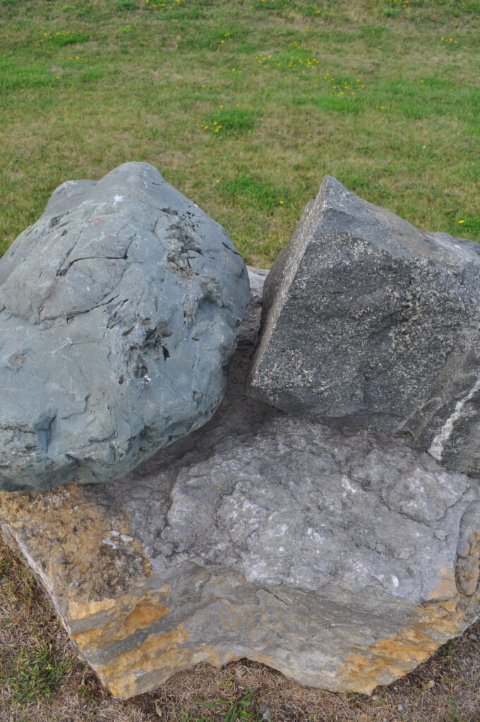
The youngest rock-type still preserved in this region, known as the “Lake Temiskaming Outlier”, is basinal dolostone of (Lower) Silurian age (about 430 to 443 Ma). The Earlton and Thornloe Formation are deposited in ocean water. They are similar to the Thorald, Guelph, and Lions Head Formations of south western Ontario, which indicate that unbroken salt water once covered both regions. The only places where such rocks can be found in this area are located in the centre of the Timiskaming Rift Valley (which moved down in relation to the adjacent rocks on its flank). This sample comes from the Claude Breault Quarry north of New Liskeard, but similar material could be found in the cliffs at Dawson Point, where depressions in farmland indicate Karst topography. The slightly older Evantual Formation, developed in the marine nearshore environment, is linked to the Manitoulin and Cabot Head Formations.
LRT#2
The “Lake Temiskaming Outlier” rock-type found immediately below the (Lower) Silurian is (Upper) Ordovician limestone (444 to 460 Ma) of the Dawson Point Formation. It is similar to the deltaic marine environments of Queenston, Georgian Bay, and Blue Mountain Formations in southern Ontario. Below these are the older Bucke and Farr Formations that are present at Haileybury and its offshore islands. This fossiliferous sample, created in a marine carbonate environment, comes from the Miller pit (west of Haileybury) as do all the pedestals on which the various samples rest around the park. Even older, the sandstone/shale of the Guigues Formation (deposited in a marine nearshore environment) compares well with the Rockcliffe Formation of the Ottawa region. An exhibit of the Guigues Formation is found at RockWalk as exhibit UNGS#6.
LRT#3
There are no Cambrian Period rock types in the local region. However, the youngest (1141 Ma) Precambrian rock-type present is a set of MesoProterozoic vertical diabase dikes known as the “Abitibi Swarm”. They are located a few kilometers apart, between Temagami and Latchford. Their sharply defined stark black mass can be seen in Ontario Hwy. #11 roadcuts. They all run in a south-east to north-west direction.
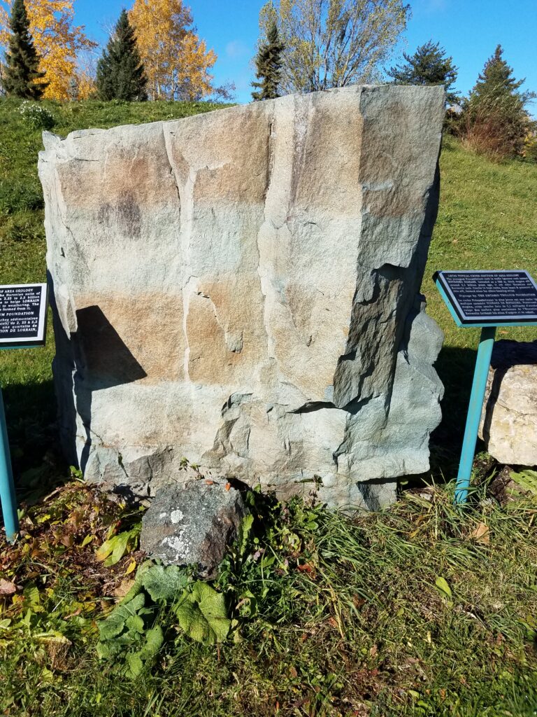
Better known (and displayed here) is the mafic intrusive igneous rock of the PaleoProterozoic Age called Nipissing Sills/Diabase (now dated at 2219 Ma). This material was intruded as a magma making up a 300 meter/1000 foot thick “sill” cutting through the Huronian and Keewatin rocks already in place. The weight and heat of this intrusion caused considerable cracking in the host rocks (both above and below) which eventually provided spaces for the emplacement of veins (e.g. calcite veins bearing native silver). As the diabase cooled, it cracked in unique jointing patterns, some of which are illustrated in the Unusual Geological Structures section of the park.
LRT#4A
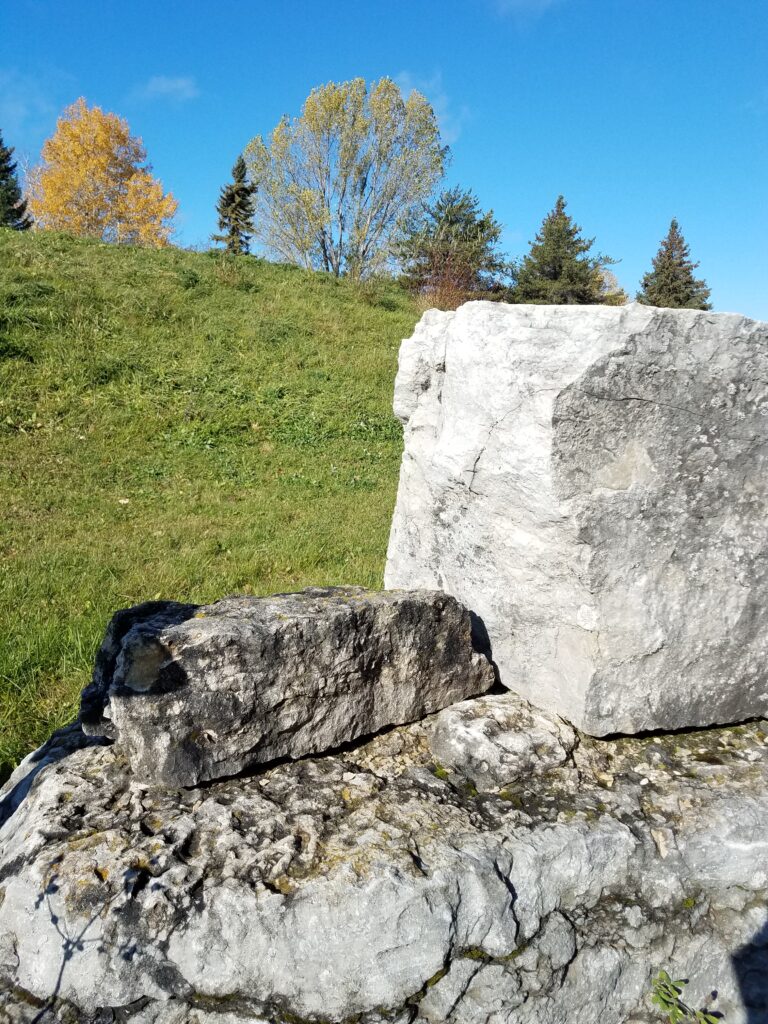
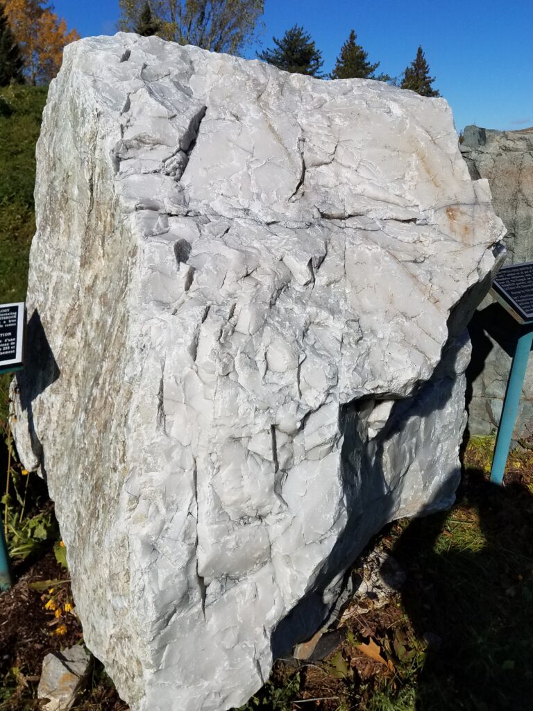
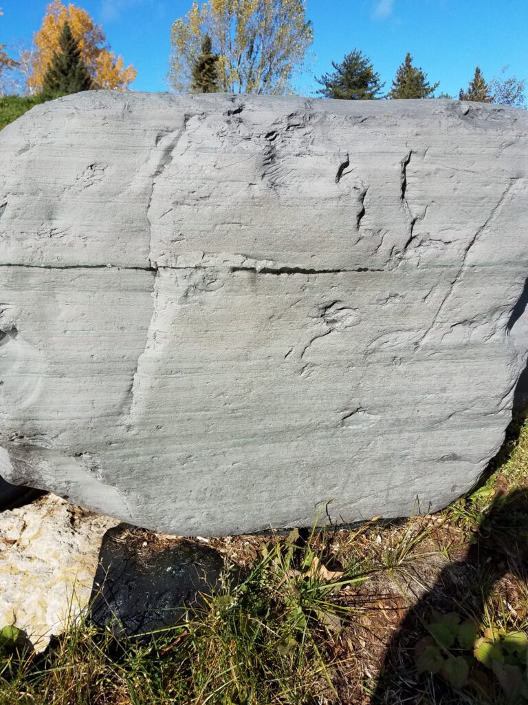
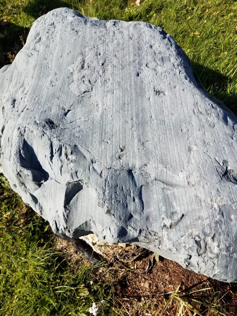
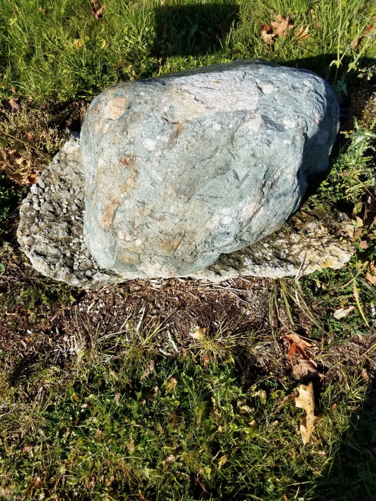
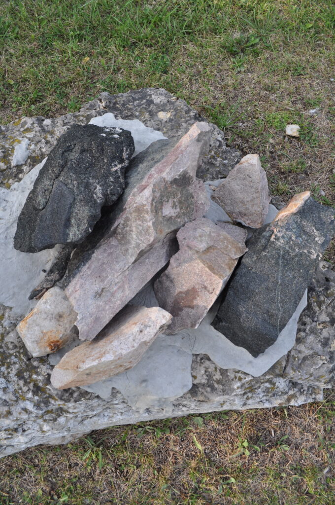
The next 7 samples are part of the “SOUTHERN PROVINCE” consisting of “Huronian Supergroup” sedimentary rocks (from 2.2 to 2.4 Ga). Recognized by geologists as the ‘Cobalt Embayment’, this variable structure can comprise up to thousands of metres of rock. The youngest Huronian rock-type shown in this display is Lorrain Formation QUARTZITE, typically white to beige in colour, and quite resistant to weathering. The name comes from the Lorrain Valley in Temiskaming, where the structure was first recognized. In fact, from Espanola to Killarney, the white distinctive La Cloche hills are composed of Lorrain Quartzite and Arkose.
The large sample shown here comes from the Lawson Quarry on the very scenic Willisville Mountain, located between Whitefish Falls and Willisville. The railway accessed quarry operated from the 1920’s, providing a fluxing agent for the smelters in Sudbury.
The exhibit was provided in 2006 by William Day Construction of Sudbury, Ontario.
LRT#4B
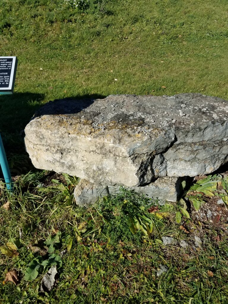
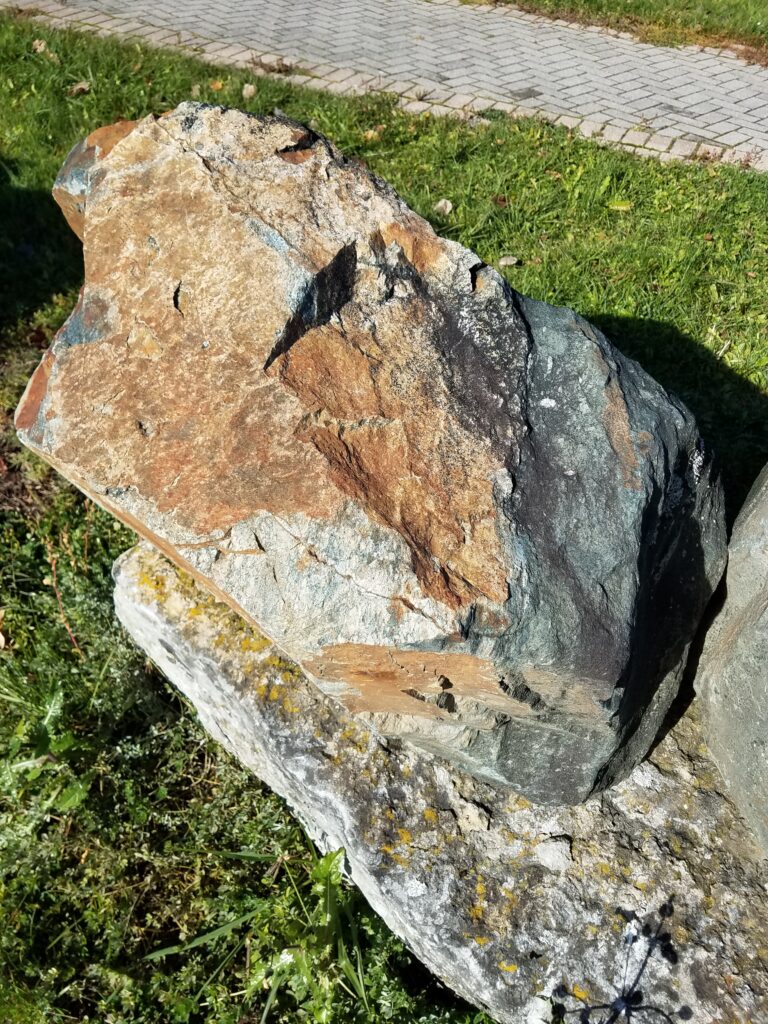
The Firstbrook member of the ‘Gowganda Formation’ is represented here, and consists of alternating layers of quartzite and ‘Slatey Greywacke’, (aka ‘Turbidites’). The result is a distinctively banded rock that has yielded many specimens for local walkways and gardens (See exhibit UNGS#105). This sample comes from the Highway #11 by-pass area west of Haileybury.
The term ‘Slatey Greywacke’ was coined for this regional rock type more than a century ago. It is now named a ‘Turbidite’ as it is created by water currents or massive failures of steep slopes under a deep ocean. These slopes fail because of excess weight on unconsolidated sediments or by shaking from earthquakes. This effect was observed in 1929 when an earthquake off the Grand Banks caused the breakage (in sequence) of a series of submarine telegraph cables. Subsequent research, concluded in 1952, recognized that ocean currents can reposition huge volumes of sediment following earthquakes and (eventually) create a distinct rock type. This indicates that the Temiskaming area was once under an ocean.
The next 5 samples make up the local Coleman member of the Gowganda Formation that is within the Huronian Supergroup of sedimentary rocks. This sequence, especially the lower parts of it, makes up the most common host rock for the silver deposits of Cobalt.
LRT#4C
The youngest and highest of these units is the so-called ‘Upper Conglomerate’. These two samples actually come from the Highway #11 road-cut at Kenogami, Ontario. However, rock of this type is widespread throughout the Cobalt camp. Actually, a conglomerate is deposited from a river, as gravel, and the pebbles are eventually cemented into place as part of a hard rock. If the cement is weak or dissolved in places, the pebbles will eventually dislodge.
Evidence for this material suggests that the ‘sediment’ was laid down by ice rather than water. That means that this rock should be called a ‘Tillite’. However, the early prospector use of the term ‘conglomerate’ is so widespread that the term is retained for local use.
LRT#4D
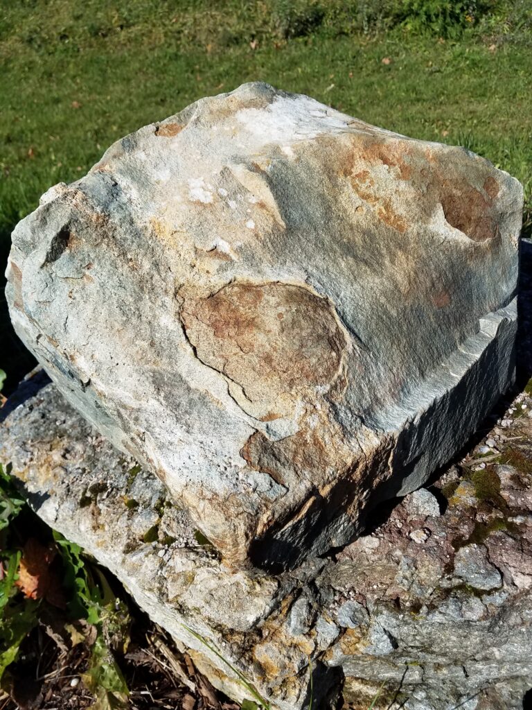
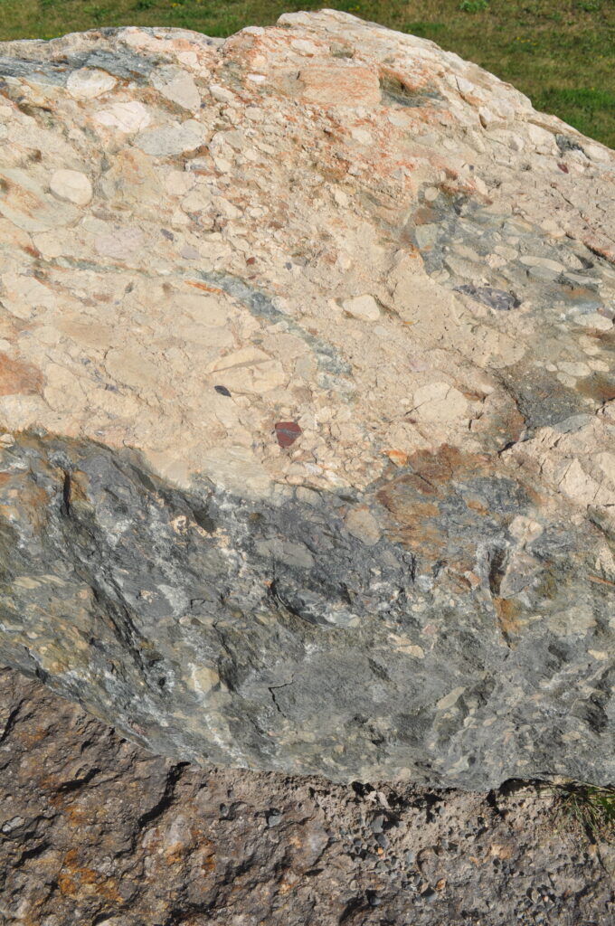
Immediately below the ‘Upper Conglomerate’ is a unit of Arkosic Quartzite. The quartzite name comes from the high quartz content, whereas the term ‘arkosic’ refers to the relatively high content of feldspar (which commonly gives a pinkish appearance to the rock). This material is quite hard and resistant to weathering, which is responsible for several prominent cliffs in this region.
LRT#4E
The rock below the Arkosic Quartzite is ‘Slatey Greywacke’ (Turbidites). As you can see, it is finely banded, and many of the bands even show ripple marks (better examples are in the Unusual Geological Structures section of the park). The similarity of this rock-type in appearance to the local varved clays suggested a similar origin for this rock among early geologists. However, it is now confirmed that such rock-types are formed as the result of turbidity currents and slumping of steep slopes in deep oceans, usually off continental shelves. About 2.2 Ga.
LRT#4F
Below the Turbidite is the Gowganda Tillite (identified originally by prospectors as ‘Lower Conglomerate’). In 1907, while working for the Ontario Bureau of Mines, geologist Arthur P. Coleman recognized that this unit showed signs of having been deposited by ice, so the term ‘Tillite’ was applied in later manuscripts. His original work on the Gowganda Tillite eventually led to the scientific agreement that Earth’s climate has continually alternated between hot and cold periods, allowing for the development and passing of a long series of ‘Ice Ages’. He is recognized locally in the name ‘Township of Coleman’ that surrounds the Town of Cobalt itself.
LRT#4G
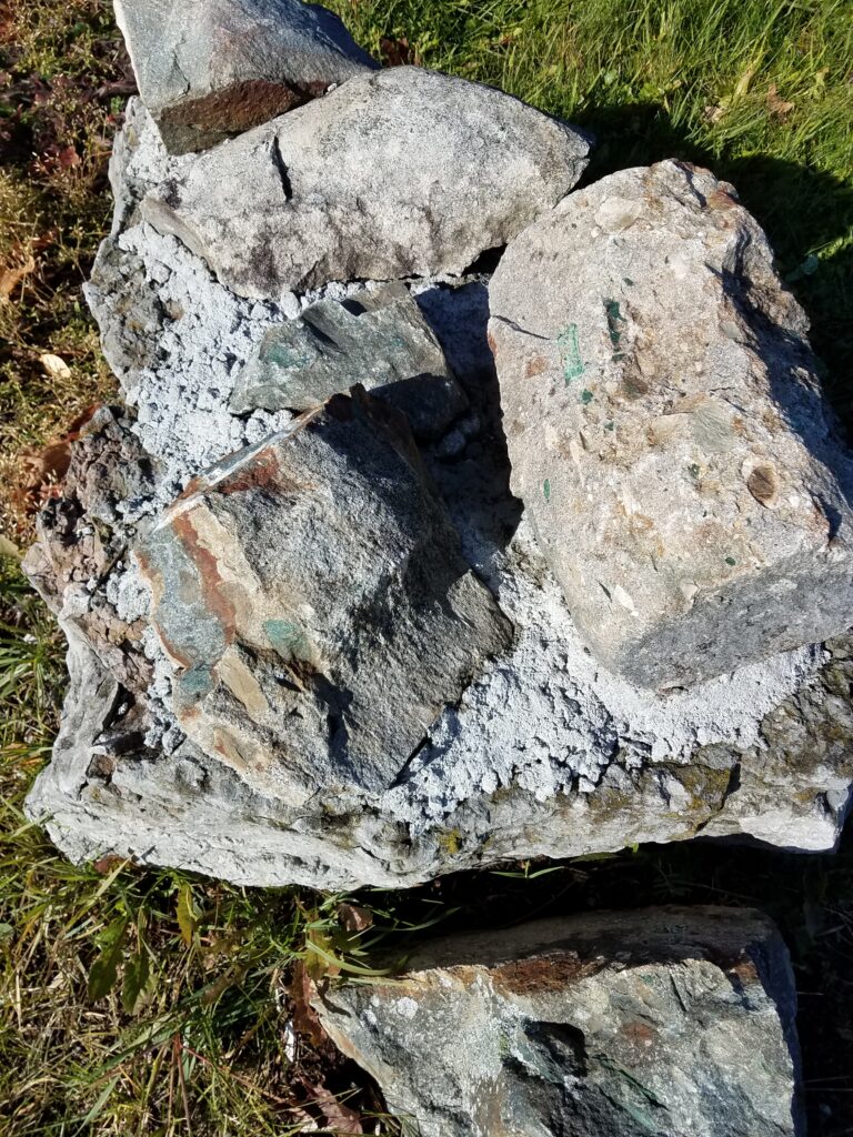
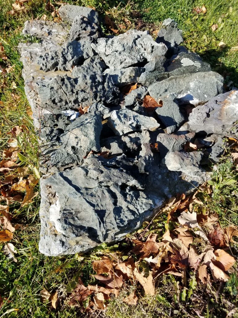
The oldest and lowest unit of the Gowganda Formation is a Basal Breccia. Essentially, such a rock-type results from the weathering of the older basement rocks, and the broken material lying around on the ancient weathered surface gets incorporated by pressure and ‘cement’ into the lower portion of the first rock-type of the local Huronian Supergroup (the Gowganda Tillite) that was deposited above. Breccia is a fragmental rock in which the fragments are angular broken pieces, often fitting together like a jigsaw puzzle, of which you can see examples in this specimen.
LRT#5A
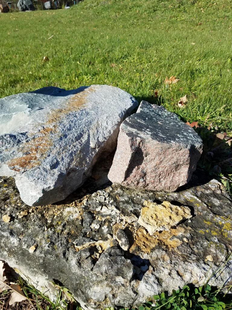
The Lorrain GRANITE was emplaced as part of a massive intrusive batholith during the Kenoran (a.k.a. Algoman) Orogeny (> 2.5 Ga). This mountain-building event was responsible for the intense folding of all older rocks (e.g. Timiskaming and Keewatin), and of a long period of erosion that peneplained (flattened) the Kenoran Mountains prior to the deposition of the Huronian Supergroup.
LRT#5B
VACANT: It is hoped that an exhibit of ‘Puddingstone’, commonly found in the vicinity of Bruce Mines (Algoma District) will be relocated here. It is not local to Temiskaming, but this pebble conglomerate occurs in the middle part of the Lorraine Formation of the Cobalt Group of the Huronian Supergroup and is dated at 2.3 Billion years old. The “Lorraine Formation” gets its name from the “Lorraine Valley” in the center of the Cobalt Mining Camp. A striking exhibit, pictures can be found on the internet. (Seek: Jasper-quartz pebble conglomerate Lorraine Formation).
LRT#5C
The local ‘lamprophyre’ is a mafic intrusive rock usually found as narrow dykes cutting through older rocks. The term was used by local prospectors as a ‘catch-all’ phrase for any dark-coloured, narrow dyke, but recent studies have shown these dykes range in composition from peridotite to hornblendite, and that only a few are true lamprophyres. There are even some which are close to either lamproite or kimberlite in composition. This lends added interest to diamond exploration in this area, where kimberlite intrusions are common as Temiskaming is on the inferred track of the ‘Great Meteor Hotspot’ that connects the diamond mines of the Northwest Territories and Ontario’s Victor Diamond Mine (closed in 2019). A second sample can be viewed at UNGS#15.
LRT#6A
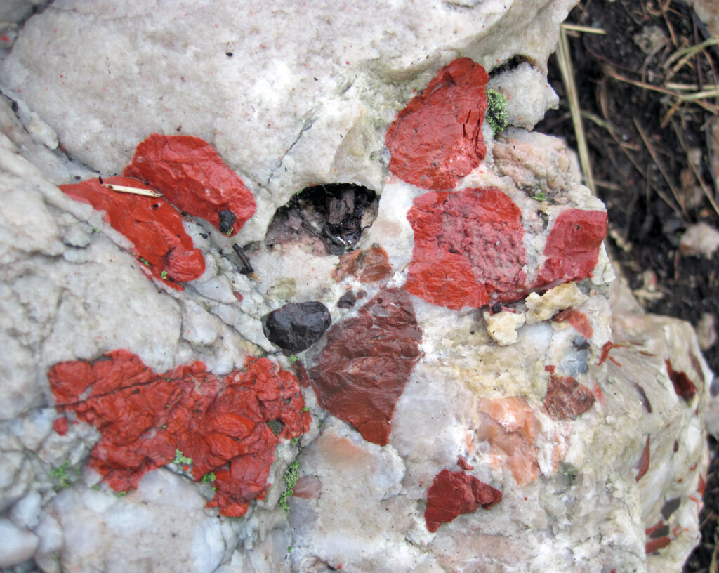
The Timiskaming rocks are composed of conglomerates, quartzites, and greywackes/Turbidites. They tend to be confined to the basement rocks extending north of Haileybury through New Liskeard, and to narrow ‘belts’ extending through Porcupine and Kirkland Lake. These conglomerates are different from the Huronian ‘conglomerates’ insofar as the pebbles are stretched or flattened, the rock-types represented by pebble types are more diverse, and some of the pebbles are made of silca/chert. Where the silica is coloured by green fuchsite mica (as around the Porcupine Mining Camp), the ‘chert’pebbles are the green rip-clasts that are illustrated here.
LRT#6B
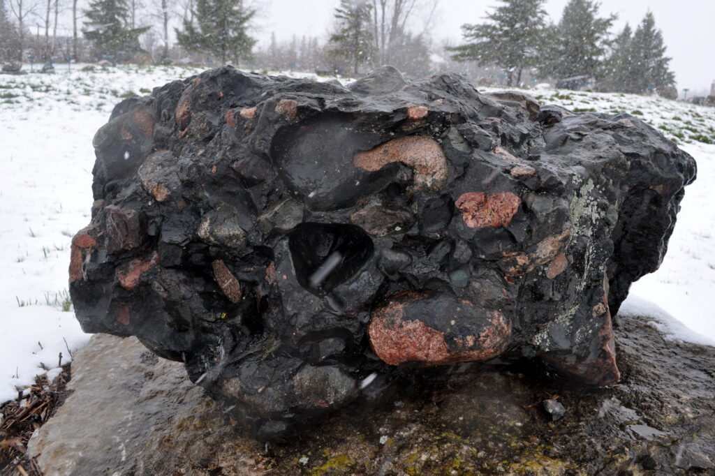
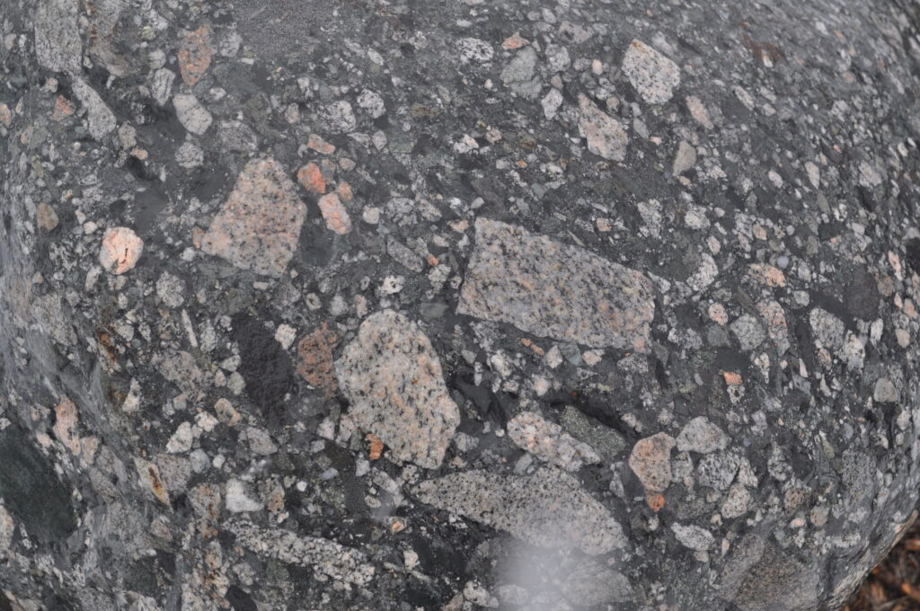
Timiskaming Conglomerate: In this exhibit, the silica/chert is stained red by hematite. This means that the red pebbles are now referred to as ‘Jasper’. This sample was obtained from Kirkland Lake, where the Hwy. #66 rock cut, adjacent to the #4 shaft headframe of Kirkland Lake Gold, is located. This is a (polymictic) conglomerate consisting of pebbles of many different rock types, including komatiite (cross-hatched appearance). It is a fluvial/alluvial fan deposit. Age is Neoarchean (2.674 Ga).
Signage sponsor: Gaetan St.-Denis, Professor, Mining, Northern College
Internet pictures…seek: komatiite-pebble conglomerate Temiskaming
LRT#7A
The oldest rocks present in the Abitibi section of the Superior Province (Kirkland Lake area) are of the Keewatin (part of the Archean section of the Precambrian – possibly up to 3 Ga). There are many Keewatin rock-types present locally, and they are all volcanic, ranging in composition from basalt to andesite to dacite to rhyolite (as the silica content gets progressively greater). Narrow local tuffaceous units contain variable amounts of pyrite, pyrrhotite, chalcopyrite, sphalerite, and galena. As a result, they hold some promise for the eventual discovery of base metal sulphide deposits. Shown is a breccia with red angular fragments.
LRT#7B
These are glacial ‘float’samples of Keewatin ‘greenstone’ (2.7+ Ga) from the moraine deposition areas both south and west of Cobalt. They include a sample that contains a quartz vein. A second sample of ‘greenstone’ contains ‘Torsion Cracks’ that look similar to cracks in ‘playdough’. For a full explanation of this feature, see exhibit UNGS#12A
Signage supplied by Caldwell Construction (New Liskeard, Ontario)
LRT#7C
The Otto Stock (2.68 Ga) is a moderate sized distinct geologic structure, found in Otto Twp. south of Swastika (Kirkland Lake). It is of syenite composition (reddish hue) and is similar to other Archean alkaline intrusives of the area. At km. 575 on Hwy.#11, the rock cut shows a tongue of syenite intruding a contact metamorphic aureole that surrounds the tongue. The (black) mafic pyroclastic rock has undergone recrystallization. This exhibit captures the concept of in situ tongue and metamorphic aureole.
LRT#7D
Andesite/Basalt VESICULES: In the center of the Cobalt mining Camp, on the eastern shore of Peterson Lake (near the Nova Scotia mill) is a rare local occurrence of a Keewatin volcanic flow. It is either an Andesite or a Basalt, but no (expensive) chemical tests have been applied. The flow is a few meters wide and is noted for its very large vesicles (magma gas bubbles). Geologists believe that the site originated deep within the earth, where the vesicles would have been small at first, but a process of very slow cooling allowed the small bubbles to join together. The formation slowly flowed toward the surface, keeping the bubbles intact while a crust formed around them. On surface, they may have been partially crushed by glaciation or other erosion processes. This process is comparable to the gasses in carbonated drinks, where molecules of gas gather together by nucleation, in order to form larger bubbles as they rise from the depths.
Display Sponsor: Candy Keith – commemorating 40 years of Pied Piper Kid Shows in Temiskaming (1979-2019)
Internet Explanation…seek: Ontario: Vesicles and Amygdules